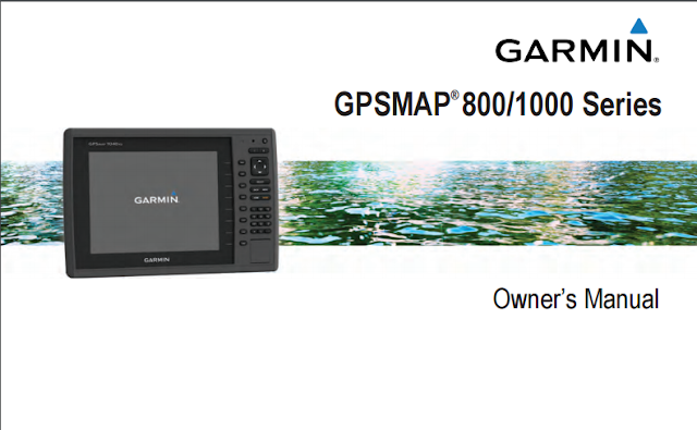
Garmin GPSMAP 840xs Manual
Download Garmin GPSMAP 840xs Manual in pdf format. Table of contents; introduction, inserting memory cards, software update, GPS satellite signals, customizing the chartplotter, setting the vessel type, adjusting the backlight, adjusting the color mode, setting up the wifi, connecting a wireless to the chartplotter, changing the wireless channel, using the garmin helm app with the chartplotter, navigation chart and offshore fishing chart, garmin quickdraw contours mapping, automatic identification system, navigation with a chartplotter, combination, creating a waypoint on the sonar screen, measuring distance on the sonar screen, turning on the a scope, sonar recordings, adjusting the radar range, adjusting the zoom scale, marking a waypoint on the radar screen, optimizing the radar display gauges and almanac information, digital selective calling, turing on DSC, position tracking, connecting a bluetooth wireless to the media player, siriusXM weather, turning on the chartplotter automatically, chartplotter data management, copying waypoints, routers and tracks from homeport to a chartplotter, copying data from a memory card, backing up data to a computer, restoring backup data to a chartplotter, saving system information to a memory card, registering your device, cleaning the screen, copying screenshots to a computer, troubleshooting, restoring the original chartplotter factory setting,
| Physical & Performance | |
| Physical dimensions | 11.5" x 7.4" x 2.9" (29.3 x 18.8 x 7.4 cm) |
| Display size, WxH | 6.4" x 4.8"; 8.0" diagonal (16.2 x 12.1 cm; 20.3 cm diagonal) |
| Display resolution, WxH | 800 x 600 pixels |
| Display type | SVGA display |
| Weight | 3.5 lbs (1.6 kg) |
| Water rating | IPX7 |
| Antenna | Internal with external connection |
| NMEA 2000® compatible | Yes |
| NMEA 0183 compatible | Yes |
| SiriusXM™ Weather & Radio compatible | Yes |
| Power consumption | Max power usage at 10 Vdc: 14 W Typical current draw at 12 Vdc: 1.1 A Max current draw at 12 Vdc: 3.2 A |
| Mounting options | Bail, flat or flush |
| Garmin Marine Network™ ports | 1 |
| Maps & Memory | |
| Preloaded maps | BlueChart® g2 (coastal maps) and LakeVü HD (inland maps) |
| Accepts data cards | 2 SD™ cards |
| Waypoints | 5,000 |
| Routes | 100 |
| Track log | 50,000 points; 50 saved tracks |
| Chartplotter Features | |
| Garmin Radar compatible | Yes |
| Garmin Sonar compatible | Yes (built-in) and GCV™ black box compatible |
| Supports AIS (tracks target ships position) | Yes |
| Supports DSC (displays position data from DSC-capable VHF radio) | Yes |
| Tide tables | Yes |
| Garmin Meteor™ Audio System compatible | Yes |
| Supports FUSION-Link™ compatible radios | Yes |
| GCV™ Black Box sonar support | Yes |
| BlueChart® Mobile (planning) compatible | Yes |
| Garmin Helm™ compatible | Yes |
| Sonar Features & Specifications | |
| Dual-frequency (50/200 kHz) sonar capable | Yes |
| Dual-beam (77/200 kHz) sonar capable | Yes |
| Frequencies supported | 50/77/200 kHz, CHIRP (low, medium, high), ClearVü |
| Transmit power | 1 kW traditional; 1 kW single channel CHIRP |
| CHIRP sonar technology | Yes (Built-in) |
| ClearVü | Yes with CHIRP (built-in) |
| SideVü | Yes (with GCV™ black box, sold separately) |
| Maximum depth | 1,750 ft @ 50 kHz, saltwater, Garmin dual freq transducer @ 500 W 2,700 ft @ 50 kHz, saltwater, Airmar B260 transducer @ 1000 W (depth capacity is dependent on water bottom type and other water conditions) |
| Bottom lock (shows return from the bottom up) | Yes |
| Water temperature log and graph | Yes |
| Sonar recording | Yes |
| Sonar history rewind | Yes |
| Connections | |
| NMEA 0183 input ports | 2 |
| NMEA 0183 output ports | 2 |
| Video input ports | None |
| Video output ports | None |
| Wireless connectivity | Yes |
| Additional | |
| Additional |
|

0 Response to "Garmin GPSMAP 840xs Manual"
Post a Comment