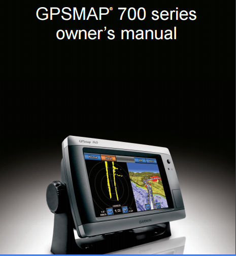
Garmin GPSMAP 740s Manual
Download Garmin GPSMAP 740s Manual in pdf format. Table of contents; introduction, tips and shortcuts, manual conventions, getting started, charts and 3D chart views, combinations, navigation, where to?, almanac, on boat and environmental data, device configuration, radar, sonar, digital selective calling, appendix, index.
 |
| Garmin GPSMAP 740s Manual |
Garmin GPSMAP 740s specifications
| Physical & Performance | |
| Physical dimensions | 8.8" x 5.6" x 3.1" (22.4 x 14.2 x 7.9 cm) |
| Display size, WxH | 6.0" x 3.6"; 7.0" diagonal (15.2 x 9.1 cm; 17.8 cm diagonal) |
| Display resolution, WxH | 800 x 480 pixels |
| Display type | Touchscreen WVGA display |
| Weight | 2.48 lbs (1.1 kg) |
| Water rating | IPX7 |
| Antenna | Internal with external connection |
| NMEA 2000® compatible | Yes |
| NMEA 0183 compatible | Yes |
| SiriusXM™ Weather & Radio compatible | Yes |
| Power consumption | Max power usage at 13 Vdc: 8.56 W Typical current draw at 12 Vdc: 0.6 A |
| Mounting options | Bail or flush |
| Garmin Marine Network™ ports | None |
| Maps & Memory | |
| Preloaded maps | BlueChart® g2 (coastal maps) |
| Accepts data cards | 1 SD™ card |
| Waypoints | 3,000 |
| Routes | 100 |
| Track log | 20,000 points; 50 saved tracks |
| Chartplotter Features | |
| Garmin Radar compatible | Yes |
| Garmin Sonar compatible | Yes |
| Supports AIS (tracks target ships position) | Yes |
| Supports DSC (displays position data from DSC-capable VHF radio) | Yes |
| Tide tables | Yes |
| Sonar Features & Specifications | |
| Dual-frequency (50/200 kHz) sonar capable | Yes |
| Dual-beam (77/200 kHz) sonar capable | Yes |
| Frequencies supported | 50/77/200 kHz |
| Transmit power | 1 kW RMS |
| Maximum depth | 2,000 ft. (depth capacity is dependent on water bottom type and other water conditions) |
| Bottom lock (shows return from the bottom up) | Yes |
| Water temperature log and graph | Yes |
| Connections | |
| NMEA 0183 input ports | 2 |
| NMEA 0183 output ports | 2 |
| Video input ports | None |
| Video output ports | None |
Download Garmin GPSMAP 740s Manual here
0 Response to "Garmin GPSMAP 740s Manual"
Post a Comment